New Pomerelia: Difference between revisions
miraheze:conworlds>Javants No edit summary |
m (20 revisions imported) |
||
| (11 intermediate revisions by 2 users not shown) | |||
| Line 1: | Line 1: | ||
{{Construction}} | |||
{{Infobox settlement | {{Infobox settlement | ||
<!-- See Template:Infobox settlement for additional fields and descriptions --> | <!-- See Template:Infobox settlement for additional fields and descriptions --> | ||
| Line 4: | Line 5: | ||
| native_name = ''Nepomerka'' | | native_name = ''Nepomerka'' | ||
| native_name_lang = pm | | native_name_lang = pm | ||
| settlement_type = [[ | | settlement_type = [[Oriental Republics of Cisplatina|Oriental Republic of Cisplatina]] | ||
| image_flag = | | image_flag = Flag of New Pomerelia.svg | ||
| image_shield = | | image_shield = | ||
| shield_size = | | shield_size = | ||
| image_map = New Pomerelia | | image_map = New Pomerelia Location.svg | ||
| map_caption = Location of New Pomerelia in the United Provinces | | map_caption = Location of New Pomerelia in the United Provinces | ||
| pushpin_map = | | pushpin_map = | ||
| Line 45: | Line 46: | ||
|blank_name = | |blank_name = | ||
|blank_info = | |blank_info = | ||
| website = | | website = www.nepomerka.com.cp | ||
}} | }} | ||
:''This article is about the oriental republic of [[Cisplatina]]. For the similar sounding state of [[Poland-Lithuania]], see [[Pomerania]].'' | |||
'''New Pomerelia''' ([[Pomerelian Language|Pomerelian]]: ''Nepomerka'', {{W|German language|German}}: ''Neue Pomerelia'', {{W|Polish language|Polish}}: ''Nowa Pomerka'', {{W|Lithuanian language|Lithuanian}}: ''Nauja Pomerelija'') is a {{W|province}} and [[Oriental Republics of Cisplatina|oriental republic]] located in the east of the [[United Provinces]], bordered by [[Paraná]] and [[Pampa]] to the west, [[Paiagua]] to the north, [[Edessa]] and [[New Cumbria]] to the east, and [[Ventena]] to the south. As one of ten maritime provinces in Cisplatina, New Pomereria has a small coastline on the {{W|Rio de la Plata|Mieczko Sea}} and also provides the outsource of Cisplatina's three largest rivers - the {{W|Uraguay River|Masson}}, {{W|Paraná River|Paraná}}, and {{W|Paraguay River|Paraguay}} rivers, each of which have formed a pivotal rule throughout the history and settlement of the United Provinces. New Pomerelia's capital and largest city, [[St. Rybicki]], is the third largest city in Cisplatina (behind only TBC and TBC) and is a leading center of education within South America, being home to the historic [[University of St. Rybicki]] as well as a vibrant and developing multi-cultural cultural scene. Long considered the bohemian capital of the United Provinces, St. Rybicki has historically been a center for the arts, political movements, and a dynamic youth culture which has given it a reputation as Cisplatina's 'wild city'. Outside of St. Rybicki, the province of New Pomerelia as a whole also functions as one of the largest agricultural producers in the United Provinces, supported by the highly fertile regions of the {{W|Uraguay Ruver|Masson River}} watershed, with other important civic centers for industry including [[Nowydom]] in the department of [[Lower Uraguay]], [[Miłberg]] in [[Ibici]], and [[Elda]] in [[New Prussia]]. | |||
What is now New Pomerelia was first settled primarily by the native Amerindian {{W|Guaraní people|Guaraní}}, {{W|Charrúa}}, {{W|Chaná}}, and {{W|Kaingang}} peoples, who at various times inhabited regions between New Pomerelia's three key rivers - the {{W|Uraguay River|Masson}}, {{W|Paraguay River|Paraguay}}, and {{W|Paraná River|Paraná}}. As a result of later colonisation of the region, little is known of the proto-history of the native peoples of New Pomerelia, although no major archaeological remains from any large-scale civilisations similar to those of the {{W|Aztecs}} or {{W|Incas}} have been uncovered, suggesting a nomadic way of life in early New Pomerelia. The first European settlers to arrive in New Pomerelia after its initial discovery by the {{W|Knights Hospitaller}} were [[Poland-Lithuania|Polish-Lithuanian]] {{W|Calvinists}} fleeing the {{W|Polish Counter-Reformation|counter-reformation}} against protestants in central Europe in 1558. The first of these, headed by the notable Calvinist theologian and explorer [[Piotr Mieczko]], secured rights from the {{W|Knights Hospitaller}} based in [[Aubusson]] (now the capital of [[Edessa]]) to establish free religious settlements further south. Shortly thereafter, Mieczko commenced a voyage along the Masson River, establishing the town of [[Nowydom]] (now the capital of [[Lower Uraguay]]) and beginning agricultural redevelopment of nearby land on the banks of the lower Masson. Attracting others persecuted as a result of religious tension within [[Poland-Lithuania]], many others soon made their way across the Atlantic to settle at [[Nowydom]] and other nearby towns, establishing what would become a fast growing Polish-speaking protestant settlement. In [[Lithuania]] and [[East Prussia]], ethnic German and Lithuanian protestants who sought religious refuge without their ethnic subjugation to the Polish, as was commonplace in [[Poland-Lithuania]] itself, also traveled to the growing colony, which had by this time been named New Pomerelia. By the late 16th century, these German and Lithuanian communities had secured rights to settlement further along the {{W|Uraguay River|Masson River}}, including in what is now [[New Prussia]] and [[Kashubia]]. | |||
As the 17th century progressed, New Pomerelia remained in a relatively stable state of steady growth, albeit remained a small territory based along the {{W|Uraguay River|Masson River}}. In accordance with the [[Treaty of Tordesillas]] of 1494, all territories belonging to papal organisations, including the {{W|Knights Hospitaller}}, would be exempt from colonial division between {{W|Spain}} and {{W|Portugal}}. As a result, New Pomerelia, as a ''de jure'' papal territory, was spared the expansion of Spanish {{W|Argentina}} into its relatively small domain of influence. Around the beginning of the 18th century, and rising more sharply with the commencement of the [[Polish-Lithuanian Wars of Constitution]] in 1737, emigration from [[Poland-Lithuania]] and {{W|Prussia}} to New Pomerelia began to increased drastically. Further settlements were established and the province's capital was moved from [[Nowydom]] to the larger and better located town of [[St. Rybicki]] further inland, which quickly grew as a result. Concurrently, a separate New Pomerelian (as opposed to Polish-Lithuanian) identity was being established with the formation of a {{W|German language|German}}-{{W|Polish language|Polish}} {{W|creole}} known as [[Pomerelian Language|Pomerelian]], which came into general use by the New Pomerelian settlers. | |||
==Administrative Divisions== | Rough History (to be incorporated): | ||
*1494, treaty of tordesillas | |||
*1558, first founding of settlements in Nowydom by Polish-Lithuanian calvanists | |||
*Beginning around 1737 emigration from Poland-Lithuania gradually increases as a result of the [[Polish-Lithuanian Wars of Constitution]], with many loyalist szlachta establishing large holdings along the river Masson. | |||
*1798, the Knights Hospitaller order collapses. New Pomerelia as being a holding of the Knights and thus of the Pope is thus void, and hence free for invasion by the Spanish. Later that year the spanish conquer New Pomerelia. | |||
*1810, Argentine wars for independence begin, which would later result in the independence of the UP. | |||
==Etymology== | |||
==History== | |||
==Geography== | |||
:''Main Article: [[Geography of New Pomerelia]].'' | |||
[[File:Iguazu_Décembre_2007_-_Panorama_7.jpg|thumb|center|1000px|Tourists on a boardwalk overlooking the {{W|Iguazu Falls}}, the largest waterfall system in the world, located in the [[Iguazu|Iguazu Department]] of northern New Pomerelia, on the border with TBC.]] | |||
Geographically, New Pomerelia is defined by its situation between the {{W|Uraguay River|Masson}}, {{W|Paraguay River|Paraguay}}, and {{W|Paraná River|Paraná Rivers}} as part of the broader geographical region of central South America commonly referred to as {{W|Mesopotamia, Argentina|Mesopotamia}}, named after the historical region between the {{W|Tigris River|Tigris}} and {{W|Euphrates River|Euphrates}} in the {{W|fertile crescent}} of the Middle East. All three major rivers in New Pomerelia empty into the {{W|Rio de la Plata|Mieczko Sea}}, which has a small coastline in the south of the province. As part of the broader {{W|Brazilian central plateau}}, New Pomerelia has a largely {{W|subtropical climate}} ({{W|Köppen Classification}}: ''Cfa'') and is subject to high levels of rainfall throughout the year, averaging some 2,000 mm of rain annually. This high level of rainfall, combined with the region's absence of a dry season, has meant that New Pomerelia is also home to significant wetlands, of which the {{W|Iberá Wetlands}} in [[Kashubia]] form the most substantial. Other important ecological landmarks in New Pomerelia include the impressive {{W|Iguazu Falls}} on the border with TBC, which forms the largest waterfall system in the world, as well as {{W|Iguazu National Park}}. | |||
As a region with a {{W|humid subtropical climate}}, New Pomerelia maintains high temperatures and levels of rainfall throughout the year, with a slight rainfall gradient existing in a north-south and east-west decreasing parallel. Summers are generally hot and more humid than winters, which have comparably lower levels of rainfall and mild to warm temperatures. In the south of New Pomerelia, particularly [[Ibici]] and [[New Silesia]], these abundant rainfalls combined with low altitudes and plains result in extremely fertile regions which form the agricultural heartlands of the province. Products such as {{W|tobacco}}, {{W|rice}}, {{W|tea}}, and {{W|cotton}} are produced at greatest quantities in the south of the province, generally to be exported internationally as the principle economic sector of New Pomerelia as a whole. | |||
===Flora and Fauna=== | |||
==Politics== | |||
===Administrative Divisions=== | |||
{| class="wikitable sortable" style="text-align:center;" | {| class="wikitable sortable" style="text-align:center;" | ||
|- | |- | ||
| Line 160: | Line 184: | ||
|[[File:St Rybicki.svg|150px]] | |[[File:St Rybicki.svg|150px]] | ||
|- | |- | ||
} | |} | ||
==Economics== | |||
==Demographics== | |||
==Culture== | |||
==See Also== | |||
[[Category:United Provinces]] [[Category:Oriental Republics]] [[Category:Javants]] | |||
Latest revision as of 05:07, 7 July 2023
This article or section is in the process of an expansion or major restructuring. You are welcome to assist in its construction by editing it as well. If this article or section has not been edited in several days, please remove this template. If you are the editor who added this template and you are actively editing, please be sure to replace this template with {{in use}} during the active editing session. Click on the link for template parameters to use.
This article was last edited by Fizzyflapjack (talk | contribs). (Update) |
| New Pomerelia Nepomerka | ||
|---|---|---|
| Oriental Republic of Cisplatina | ||
| ||
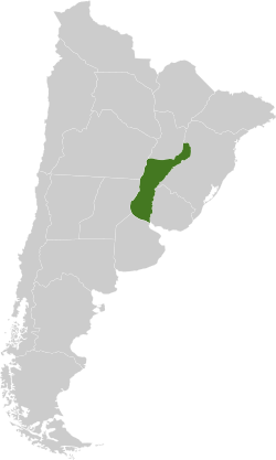 Location of New Pomerelia in the United Provinces | ||
| Country | Cisplatina | |
| Official Languages | English, Pomerelian | |
| Capital | St. Rybicki | |
| Government | ||
| • Governor | James Kosciusko-Engels (CSDP) | |
| • Senator | David Rudasz-Kahnwald (N) | |
| Population (2015)UTC−3 | ||
| • Total | 9,109,280 | |
| • Rank | 7 | |
| Demonym(s) | Pomerelian | |
| Time zone | UTC−3 | |
| Website | www.nepomerka.com.cp | |
- This article is about the oriental republic of Cisplatina. For the similar sounding state of Poland-Lithuania, see Pomerania.
New Pomerelia (Pomerelian: Nepomerka, German: Neue Pomerelia, Polish: Nowa Pomerka, Lithuanian: Nauja Pomerelija) is a province and oriental republic located in the east of the United Provinces, bordered by Paraná and Pampa to the west, Paiagua to the north, Edessa and New Cumbria to the east, and Ventena to the south. As one of ten maritime provinces in Cisplatina, New Pomereria has a small coastline on the Mieczko Sea and also provides the outsource of Cisplatina's three largest rivers - the Masson, Paraná, and Paraguay rivers, each of which have formed a pivotal rule throughout the history and settlement of the United Provinces. New Pomerelia's capital and largest city, St. Rybicki, is the third largest city in Cisplatina (behind only TBC and TBC) and is a leading center of education within South America, being home to the historic University of St. Rybicki as well as a vibrant and developing multi-cultural cultural scene. Long considered the bohemian capital of the United Provinces, St. Rybicki has historically been a center for the arts, political movements, and a dynamic youth culture which has given it a reputation as Cisplatina's 'wild city'. Outside of St. Rybicki, the province of New Pomerelia as a whole also functions as one of the largest agricultural producers in the United Provinces, supported by the highly fertile regions of the Masson River watershed, with other important civic centers for industry including Nowydom in the department of Lower Uraguay, Miłberg in Ibici, and Elda in New Prussia.
What is now New Pomerelia was first settled primarily by the native Amerindian Guaraní, Charrúa, Chaná, and Kaingang peoples, who at various times inhabited regions between New Pomerelia's three key rivers - the Masson, Paraguay, and Paraná. As a result of later colonisation of the region, little is known of the proto-history of the native peoples of New Pomerelia, although no major archaeological remains from any large-scale civilisations similar to those of the Aztecs or Incas have been uncovered, suggesting a nomadic way of life in early New Pomerelia. The first European settlers to arrive in New Pomerelia after its initial discovery by the Knights Hospitaller were Polish-Lithuanian Calvinists fleeing the counter-reformation against protestants in central Europe in 1558. The first of these, headed by the notable Calvinist theologian and explorer Piotr Mieczko, secured rights from the Knights Hospitaller based in Aubusson (now the capital of Edessa) to establish free religious settlements further south. Shortly thereafter, Mieczko commenced a voyage along the Masson River, establishing the town of Nowydom (now the capital of Lower Uraguay) and beginning agricultural redevelopment of nearby land on the banks of the lower Masson. Attracting others persecuted as a result of religious tension within Poland-Lithuania, many others soon made their way across the Atlantic to settle at Nowydom and other nearby towns, establishing what would become a fast growing Polish-speaking protestant settlement. In Lithuania and East Prussia, ethnic German and Lithuanian protestants who sought religious refuge without their ethnic subjugation to the Polish, as was commonplace in Poland-Lithuania itself, also traveled to the growing colony, which had by this time been named New Pomerelia. By the late 16th century, these German and Lithuanian communities had secured rights to settlement further along the Masson River, including in what is now New Prussia and Kashubia.
As the 17th century progressed, New Pomerelia remained in a relatively stable state of steady growth, albeit remained a small territory based along the Masson River. In accordance with the Treaty of Tordesillas of 1494, all territories belonging to papal organisations, including the Knights Hospitaller, would be exempt from colonial division between Spain and Portugal. As a result, New Pomerelia, as a de jure papal territory, was spared the expansion of Spanish Argentina into its relatively small domain of influence. Around the beginning of the 18th century, and rising more sharply with the commencement of the Polish-Lithuanian Wars of Constitution in 1737, emigration from Poland-Lithuania and Prussia to New Pomerelia began to increased drastically. Further settlements were established and the province's capital was moved from Nowydom to the larger and better located town of St. Rybicki further inland, which quickly grew as a result. Concurrently, a separate New Pomerelian (as opposed to Polish-Lithuanian) identity was being established with the formation of a German-Polish creole known as Pomerelian, which came into general use by the New Pomerelian settlers.
Rough History (to be incorporated):
- 1494, treaty of tordesillas
- 1558, first founding of settlements in Nowydom by Polish-Lithuanian calvanists
- Beginning around 1737 emigration from Poland-Lithuania gradually increases as a result of the Polish-Lithuanian Wars of Constitution, with many loyalist szlachta establishing large holdings along the river Masson.
- 1798, the Knights Hospitaller order collapses. New Pomerelia as being a holding of the Knights and thus of the Pope is thus void, and hence free for invasion by the Spanish. Later that year the spanish conquer New Pomerelia.
- 1810, Argentine wars for independence begin, which would later result in the independence of the UP.
Etymology
History
Geography
- Main Article: Geography of New Pomerelia.

Geographically, New Pomerelia is defined by its situation between the Masson, Paraguay, and Paraná Rivers as part of the broader geographical region of central South America commonly referred to as Mesopotamia, named after the historical region between the Tigris and Euphrates in the fertile crescent of the Middle East. All three major rivers in New Pomerelia empty into the Mieczko Sea, which has a small coastline in the south of the province. As part of the broader Brazilian central plateau, New Pomerelia has a largely subtropical climate (Köppen Classification: Cfa) and is subject to high levels of rainfall throughout the year, averaging some 2,000 mm of rain annually. This high level of rainfall, combined with the region's absence of a dry season, has meant that New Pomerelia is also home to significant wetlands, of which the Iberá Wetlands in Kashubia form the most substantial. Other important ecological landmarks in New Pomerelia include the impressive Iguazu Falls on the border with TBC, which forms the largest waterfall system in the world, as well as Iguazu National Park.
As a region with a humid subtropical climate, New Pomerelia maintains high temperatures and levels of rainfall throughout the year, with a slight rainfall gradient existing in a north-south and east-west decreasing parallel. Summers are generally hot and more humid than winters, which have comparably lower levels of rainfall and mild to warm temperatures. In the south of New Pomerelia, particularly Ibici and New Silesia, these abundant rainfalls combined with low altitudes and plains result in extremely fertile regions which form the agricultural heartlands of the province. Products such as tobacco, rice, tea, and cotton are produced at greatest quantities in the south of the province, generally to be exported internationally as the principle economic sector of New Pomerelia as a whole.
Flora and Fauna
Politics
Administrative Divisions
| Flag | Department | Native Name | Population (2017 census) | Capital | Map |
|---|---|---|---|---|---|
| East Kashubia-Ibera | Ostkaszubia-Ibera | 726,380 | Ibera | 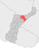
| |
| Ibici | Ibici | 726,380 | Miłberg | 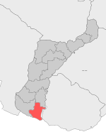
| |
| Igazu | Igacu | 726,380 | Fall | 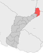
| |
| Jabłkoberg | Jabłkoberg | 726,380 | Cytrybau | 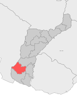
| |
| Jasereta | Iasyreta | 726,380 | Ariana | 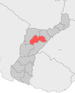
| |
| Kashubia | Kaszubia | 726,380 | Heiberg | 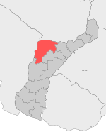
| |
| Lower Uruguay | Miłurugwaj | 726,380 | Nowydom | 
| |
| New Kielce | Nekielce | 726,380 | New Kielce | 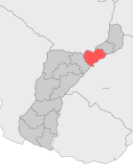
| |
| New Prussia | Nepruszy | 726,380 | Elda | 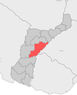
| |
| New Silesia | Neszlaska | 726,380 | Głalecberg | 
| |
| Rakowberg | Rakówberg | 726,380 | St. Andrzej | 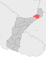
| |
| South Masuria | Zudmazury | 726,380 | St. Ełukas | 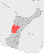
| |
| South Prussia-Rzekiberg | Zudpruszy-Rzekiberg | 726,380 | St. Piotr | 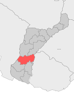
| |
| St. Rybicki | St. Rybicki | 726,380 | St. Rybicki | 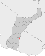
|
