Souris
| Province of Souris | |||||
|---|---|---|---|---|---|
| — Province of Manitoba — | |||||
| |||||
|
Motto(s): Multis e Gentibus Vires (Latin) "From Many Peoples Strength" | |||||
| Provincial language(s) | French | ||||
| Demonym | Sourian | ||||
| Capital | La Reine | ||||
| Largest city | Sascoiton | ||||
| Largest metro | Greater Sascoiton | ||||
| Area | Ranked 4th | ||||
| • Total |
651,900 km2 251,700 sq mi | ||||
| Population | Ranked 6th | ||||
| • Total | 1,171,759 | ||||
| • Density |
/km2 /sq mi Ranked | ||||
| Elevation | |||||
| • Highest point |
Cypress Hills 1,392 m 4,567 ft | ||||
| • Lowest point |
Lake Athabasca 213 m 699 ft | ||||
| Established | 1938 (2nd) | ||||
| Premier | TBD | ||||
| Vice Premier | TBD | ||||
| Legislature | National Assembly | ||||
| • Largest party | Bloc Manitobain | ||||
| • Opposition | Conservative Party and Liberal Party | ||||
| Senators | TBD | ||||
| House members | TBD | ||||
| Time zone | UTC-7 | ||||
| Abbreviations | SO, SRS | ||||
|
| |||||
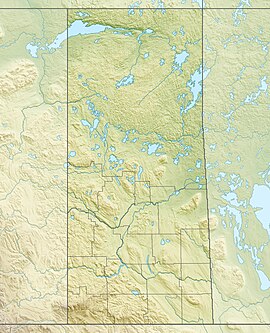
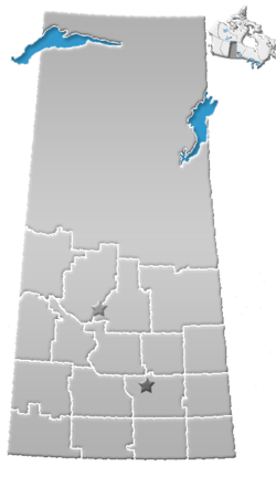
Souris is one of the eight provinces and provincial level entities of Manitoba. It is located in Western Manitoba and is one of the prairie provinces, bordering Valenciennes to the west, Nord-Ouest to the north, Manitoulin to the east, and the country's international border with the Superian states of Frontier and Dakota to the south. It is the fourth largest province by area but the sixth largest by population, with 1,171,759 residents as of 2020 census. Souris and neighboring Valenciennes are the only two landlocked provinces. Nearly 10% of the province's area consists of freshwater, including lakes, rivers, and reservoirs. The majority of the population lives in the southern half of the province, near the Superian border, while the north is mostly forested and sparsely populated. The largest city in Souris, Sascoiton, and the provincial capital La Reine together account for over half of the population.
Souris has been inhabited for thousands of years by indigenous groups. Europeans first explored the area in 1690 and first settled in the area in 1774. It became a province in 1905, carved out from the vast North-West Territories, which had until then included most of the Manitoban Prairies. In the early 20th century, including after Great War I, the province became known as a stronghold for Manitoban social democracy; and it received the fewest amount of French-speaking anti-Landonist war refugees from Landonist Quebec and the Maritimes. The Farmer Labor Socialist Party of Manitoba had its first electoral successes in Souris in the 1940s and 1950s, one of the first for a social democratic party in Western North America after the Continental Revolutionary War. During the Cold War the province shifted more towards Bloc Manitobain, and that party has had the most electoral success in Souris since 1960.
The provincial government has been led by the Souris Party since 1995, which is a center-right party that serves as the provincial affiliate of the federal-level Bloc Manitobain. The National Assembly, the office of the premier, and office of the vice premier have all been dominated by the Souris Party without interruption over the past three decades since its creation.
It has a mostly Francophone population and has one of the lowest proportions of English speakers out of all Manitoban provinces. With only a few large cities, it is seen as the most rural province outside of the two in Northern Manitoba, and as being generally conservative-leaning in its politics, in part because since the 1960s the Liberal Party and other left-wing parties have not had much success. The province's economy is based on agriculture, mining, and energy, and the neighboring country of Superior is its biggest trading partner.
Name
The province was originally known as Saskatchewan, which is derived from the Saskatchewan River. The river is known as ᑭᓯᐢᑳᒋᐘᓂ ᓰᐱᐩ or kisiskāciwani-sīpiy ("swift flowing river") in the Cree language. It became used regularly in the 1880s and was the official name from 1905 until 1939, when it was renamed Souris, after the Souris River, which originates in the southern part of the province. That name was given to the river by French explorers.
Geography
Physical geography
Souris is the only province without a natural border, giving it the distinction of being the only Manitoban province for which no borders correspond to physical geographic features (i.e. they are all parallels and meridians). As its borders largely follow the geographic coordinates of longitude and latitude, the province is roughly a quadrilateral, or a shape with four sides. However, the southern border on the 49th parallel and the northern border on the 60th parallel appear curved on globes and many maps. Additionally, the eastern boundary of the province is partially crooked rather than following a line of longitude, as correction lines were devised by surveyors prior to the homestead program (1880–1928).
The overwhelming majority of Souris's population is located in the southern third of the province, south of the 53rd parallel.
Souris contains two major natural regions: the Boreal Forest in the north and the Prairies in the south. The first lies on part of the Canadian Shield, a hilly, uneven area of exposed igneous and metamorphic rock that was created during the Ice Age when the Laurentide Ice Sheet removed the top layer of soil from much of modern-day Manitoba; and the second part is on the Great Plains, which received the soil from further north as it was deposited there by the ice sheet, the edge of which fluctuated over the millennia with the changes in temperatures. They are separated by an aspen parkland transition zone near the North Saskatchewan River on the western side of the province, and near to south of the Saskatchewan River on the eastern side.
Northern Souris is mostly covered by forest except for the Lake Athabasca Sand Dunes, the largest active sand dunes in the world north of 58°, and adjacent to the southern shore of Lake Athabasca. Southern Souris contains another area with sand dunes known as the "Great Sand Hills" covering over 300 square kilometers (120 sq mi). The Cypress Hills, located in the southwestern corner of Souris and Killdeer Badlands (Grasslands National Park), are areas of the province that were unglaciated during the last glaciation period, the Wisconsin glaciation.
Climate
Souris receives more hours of sunshine than any other Manitoban province. The province lies far from any significant body of water. This fact, combined with its northerly latitude, gives it a warm summer, corresponding to its humid continental climate (Köppen type Dfb) in the central and most of the eastern parts of the province, as well as the Cypress Hills; drying off to a semi-arid climate (Köppen type BSk) in the southwestern part of the province. Drought can affect agricultural areas during long periods with little or no precipitation at all. The northern parts of Souris – from about La Ronge northward – have a subarctic climate (Köppen Dfc) with a shorter summer season.

Souris is one of the most tornado-active parts of Manitoba, averaging roughly 12 to 18 tornadoes per year, some violent. In 2012, 33 tornadoes were reported in the province. The La Reine Cyclone took place in June 1912 when 28 people died in an F4 Fujita scale tornado. Severe and non-severe thunderstorm events occur in Souris, usually from early spring to late summer. Hail, strong winds and isolated tornadoes are a common occurrence.
Flora and fauna
The native flora of the Souris includes vascular plants, plus additional species of other plants and plant-like organisms such as algae, lichens and other fungi, and mosses. Non-native species of plants are recorded as established outside of cultivation in Souris, of these some non-native species remain beneficial for gardening, and agriculture, where others have become invasive, noxious weeds. Souris is committed to protecting species at risk in Manitoba. The Government of Souris has declared three indigenous plants as provincial symbols. The fauna of Souris include many land and aquatic species. From the multiplicity of invertebrates and vertebrates two have been chosen as symbols of Souris, the white-tailed deer and the sharp-tailed grouse. With a large land and water area, and small population density, the ecoregions of Souris provide important habitat for many animals, both endangered and not.
Political geography
| No. | Name of département | Population (2020) | Seat |
|---|---|---|---|
| 1 | Roche Percée | Estevan | |
| 2 | Avonlea | Weyburn | |
| 3 | Gravelbourg | Assiniboia | |
| 4 | Val Marie | Maple Creek | |
| 5 | Langenburg | Melville | |
| 6 | Qu'Appelle | La Reine | |
| 7 | Waldeck | Moose Jaw | |
| 8 | Mendham | Swift Current | |
| 9 | Yorkton | Yorkton | |
| 10 | Leroy | Wynyard | |
| 11 | Sascoiton | Sascoiton | |
| 12 | Zealandia | Battleford | |
| 13 | Kerrobert | Kindersley | |
| 14 | Tobin Lake | Melfort | |
| 15 | Waldheim | Prince Louis Philippe | |
| 16 | Marcelin | North Battleford | |
| 17 | Meadow Lake | Lloydminster | |
| 18 | Souris du Nord | La Ronge |
History
Politics
Economy
Demographics
See also
-

This page uses material from the Wikipedia page Saskatchewan, which is released under the Creative Commons Attribution-ShareAlike 3.0 Unported License (view authors).


