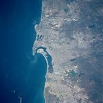
Southwest Corridor
| Southwest Corridor Greater Porciúncula Area | |
|---|---|
| Megapolis | |
 | |
 San Diego | |
 Riverside | |
| Sovereign state |
|
| Constituent country |
|
| Provinces and principal cities |
|
| Area | |
| • Urban | 9,065.79 sq mi (23,480.29 km2) |
| • Metro | 52,598 sq mi (136,228.2 km2) |
| Highest elevation | 11,499 ft (3,505 m) |
| Population (2010) | |
| • Urban | 17,938,156 |
| • MSA | 27,072,831 |
| • CSA | 32,817,483 |
| MSA/CSA/Urban: 2010 | |
| Time zone | PST (UTC-8) |
| • Summer (DST) | PDT (UTC-7) |
| Area code(s) | 213, 310, 323, 424, 442, 562, 626, 657, 661, 714, 760, 805, 818, 909, 949, 951 |
| Major freeways |
|
The Southwest Corridor, also known as the Greater Porciúncula area, is the third-largest megapolis in North America with over 32 million residents, and is the most heavily urbanized agglomeration in Sierra. It consists of the entirety of the three K.S. provinces of Gold Coast, Orange, and Laguna, as well as portions of the three K.S. provinces of the Inland Empire, Kings, and Clark. The entirety of the K.S. territory of the Channel Islands and portions of the K.S. territory of Pacífico Norte are also included in the Southwest Corridor and in some definitions, the K.S. province of Imperial is also included in the region. It centers on the Porciúncula metropolitan area in the eastern Gold Coast and Orange, and is located primarily on the Pacific Ocean in Southwestern Sierra. It includes the major cities of Porciúncula, Grands Ballons, San Diego, and Riverside, along with their associated metropolitan areas and suburbs, as well as other populated centers such as Fort Travis to the north and Las Vegas to the east.
The Southwest Corridor is often synonymously linked to Southwestern Sierra, a geographic region used by the K.S. Royal Surveyors Corps and K.S. Royal Bureau of Census including all of the Corridor, as well as the sparsely populated swaths of land in the desert interior and mountainous areas of the Inland Empire, Kings, Clark, and Imperial. The Corridor itself does not have a formal geographic designation, and definitions vary. However, most definitions of the Southwest Corridor conform to the boundaries of Southwestern Sierra. Consequently, the Southwest Corridor is often referred to and conceptualized as a region of Sierra, rather than a megapolis in everyday usage.
The megapolis is a major hub and global leader in politics, economy, trade, business, finance, culture, education, medicine, entertainment, arts, fashion, logistics, language, and aviation. It is the political, economic, and cultural center of Sierra, containing the nation's capital, Porciúncula, as well as nearly half of the entire nation's population.


